Wildfires and air pollution – How air quality sensing can help to quench wildfires
When talking about the sources of air pollution, we tend to think of man-made sources, such as transport and industry. However, the environment can be just as responsible for releasing foreign substances into the atmosphere. In this article, we will focus on one natural source in particular: wildfires.
What are wildfires?
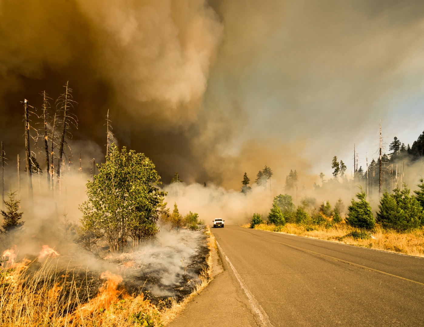
A wildfire is an uncontrolled fire that burns in a variety of ecosystems such as forests, grasslands, brushlands, and savannas. Fires can be started by human activity or by natural phenomena, such as lightning. The frequency and intensity of wildfires have increased in recent decades due to the dryness, drought, low humidity and rising temperatures brought forth by climate change.
There are no geographical limitations to wildfires; they exist on every continent and in all types of environments. Weather and topography play a role in their intensity, spread, and duration. Wildfires are essential to the environment, too: they benefit certain plant species and keep ecosystems healthy by assisting in propagation and by clearing underbrush for new growth. However, they can also be deadly when spread out of control by injuring individuals, damaging properties and resources, and disrupting communication, transportation, water supplies, power, and gas.
Intense wildfires are also capable of creating their own local weather systems by generating extreme heat and energy, making them wildly unpredictable and incredibly dangerous. Thunderstorms can be formed through the rising of hot air, which cools and condenses on ash to create a cloud called a pyrocumulus. If the wildfire is large enough, it can even create a pyrocumulonimubus (pyroCb), a firestorm cloud, which can send down rain and lightning. While the rain may help with the fire, it typically isn’t enough. Rather, the resulting lightning can spark new wildfires as the cloud advances across the landscape. Wildfires can also produce their own winds, whirls, and even tornadoes. This occurs when plumes of hot air rise rapidly, which create vacuums that pull surrounding air into the columns. Local topography and wind direction then determine the intensity and severity of the resulting winds.
What pollutants are released by wildfires? What are the health effects of wildfire smoke?
Wildfires produce carbon monoxide (CO), carbon dioxide (CO2), nitrogen oxides (NOx), methane (CH4), and particulate matter (PM) among other pollutants. These air pollutants irritate the eyes, lungs, nose, and throat, exacerbate asthma and existing cardiovascular diseases, and cause respiratory infections such as colds, bronchitis, and pneumonia. Specifically, tiny PM particles can penetrate deep into the respiratory and circulatory systems, damaging the lungs, heart, and brain. In fact, particulate matter from wildfires have been found to be four times more deadly than their normal atmospheric counterparts.
In addition, wildfires produce carcinogens such as aldehydes and polycyclic aromatic hydrocarbons. Mercury, a known poison, has also been found in wildfire smoke, which can cause muscle weakness, speech impairment, and vision problems.
The global estimate for premature deaths attributed to wildfires is over 339,000 every year.
How can wildfires be detected?
Satellites are often the first to detect wildfires in remote regions. Aside from tracking, they are also used for fire forecasting and risk assessment The Global Fire Assimilation System (GFAS) uses information from satellite-based sensors to provide estimates of pollutant emissions, while the Global Atmosphere Watch Programme studies the variability and trends in atmospheric composition for research, forecasts, and development of future warning systems. Unfortunately, there are limitations to satellite imaging: It is difficult to precisely pinpoint fire location and size due to averaging the heat signatures detected over the satellite camera’s pixels, not to mention weather conditions such as cloud cover. Other methods of reporting wildfires include public hotlines, lookout stations, and ground and aerial patrols. However, these are subject to human error and can be costly.
Current studies have found that Earth’s boreal forests are burning at an unprecedented rate not seen in 10,000 years and that wildfire season has increased by 25.3% across global vegetated areas. Hence, new and innovative monitoring solutions are now imperative. Expanding air quality networks in cities can make wildfire detection easier. Today, Breeze Technologies offers sensors that monitor all common air quality parameters. These can be used to identify patterns of emitted pollutants to accurately locate wildfires, thus allowing governments to take immediate and effective action.
We are currently extending the data analytics capabilities of our Environmental Intelligence Cloud to identify wildfire ignition location, track fire perimeters and characteristics, and provide geographical notifications and warnings in real-time. This effort is happening in collaboration with the US Department of Homeland Security (DHS) Science and Technology Directorate’s (S&T) wildfire work track. The work is our next step in leveraging our fully-digital environmental sensing solutions for a safer and healthier tomorrow.
Are you interested in working with us on early wildfire detection based on real-time ambient air quality data? Then reach out to us today!
 Banco Santander