One hackathon, one weekend, one app: Breeze Technologies at NASA’s International Space Apps Challenge
 Breeze Technologies
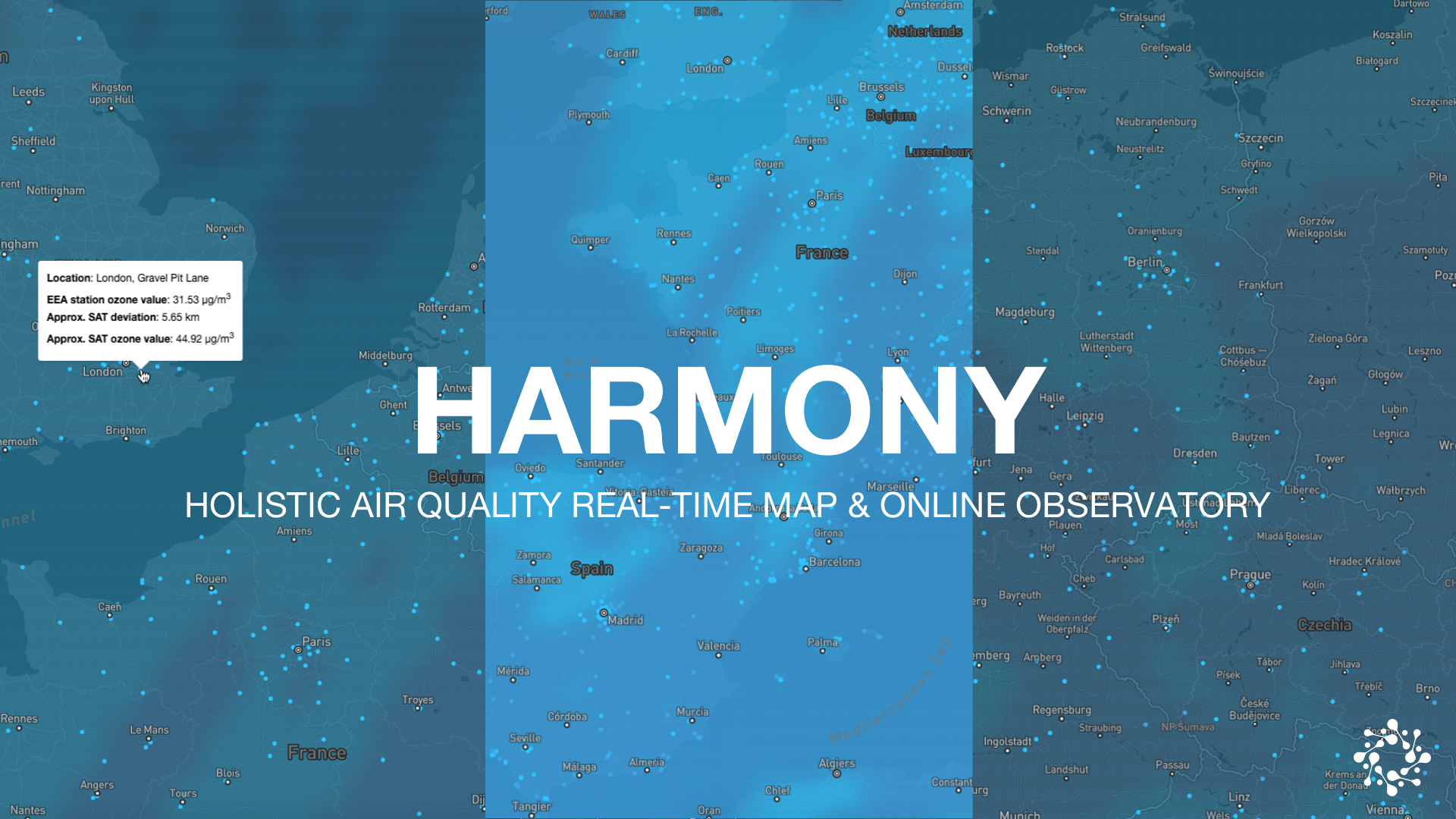
As part of NASA’s Global Space Apps Challenge 2019, our team has developed HARMONY, an environmental intelligence map that allows the near real-time monitoring of indicative satellite air quality data and an evaluation of satellite data quality in comparison to public air quality monitoring stations. We were even selected as Global Nominees by NASA’s team.
Space Apps is annual NASA’s global hackathon, first held in April 2012, and serves as innovation incubation and civic engagement program. You can watch our project video below.
NASA’s hackathon challenge was focussed on combining insights from earth observation (i.e satellite) data and ground-based monitoring stations:
Your challenge is to integrate NASA data, ground-based air quality data, and citizen science data to create an air quality surface that displays the most accurate data for a location and time. Create algorithms that select or weight the best data from several sources for a specific time and location, and display that information.
NASA’s International Space Apps Challenge
Integrating earth observation and ground-based air quality data
In response to this challenge, our has developed an environmental intelligence map that allows the near real-time monitoring of indicative satellite air quality data and an evaluation of satellite data quality in comparison to public air quality monitoring stations.
The number of the existing surface air quality monitoring stations of the local authorities is insufficient and the traditional evaluation techniques are very expensive. This means that traditional air quality monitoring stations are often kilometres apart; providing data that is neither geospatially relevant, nor available in real-time or in a comprehensible form. For citizens, it is almost impossible to get complete and accurate AQ information for their neighbourhood.
Earth observation data from satellites has the potential to improve data availability by predicting pollution levels to overcome these measurement gaps. However, surface data needs to be used to recalibrate and improve the earth observation data.
A combination of both ground-based and satellite-based air quality monitoring data can be a powerful tool to validate and monitor air quality on a large scale in cities world-wide. This is why we have created HARMONY (the Holistic Air quality Real-time Map and ONline observatorY).
Breeze Technologies’ HARMONY provides a complete overview of the current air quality and pollution concentration in Europe, based on municipal monitoring stations and earth observation data from NASA and ESA. Additionally, HARMONY enables researchers to identify data offsets between satellite data and ground-based monitoring stations to provide the means for further data calibration.
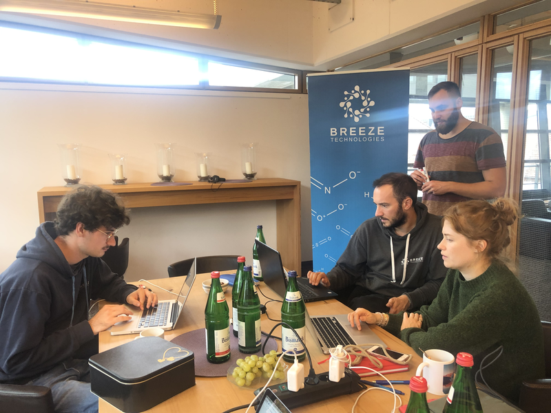
Working at Breeze Technologies is like an everyday hackathon
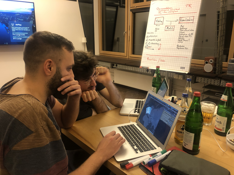
Hackathons are great: A bunch of people come together for a couple of days and work together to solve a singular problem. If you are already familiar with each other, for instance by working together in the same company, the result of the hackathon can already be quite substantial. Below you find an excerpt of updates we shared via NASA’s platform and our social media channels during the hackathon.
Happy NASA Space Apps Challenge! Our team is working hard this weekend on a tighter integration of satellite data into our air quality platform, calibration algorithms and data visualisation.
Oct 18, 14:31 CEST, Link
Here we are giving you a sneak peak into our activities. We will supply you with a constant stream of updates on our progress over this weekend.
Space Apps is annual NASA’s global hackathon, first held in April 2012, and serves as innovation incubation and civic engagement program.
#SpaceApps #SpaceAppsHAMBURG19
More information about our startup Breeze Technologies: www.breeze-technologies.de
More updates also on our Facebook page: www.facebook.com/breezetechnologies
We have been reviewing what’s already out there – and most of the current tools to engage with earth observation data on air quality are terrible!
Oct 18, 16:01 CEST, Link
It’s definitely time for a user-friendly and easily understandable solution. Luckily that’s our speciality! Let’s see what we come up with over this weekend. 🤘
#SpaceApps #SpaceAppsHAMBURG19
Our developers are already hard at work! Currently, they are integrating real-time earth observation data into our main air quality data models. This will be the groundwork for all development in our user-facing apps.
Oct 18, 18:09 CEST, Link
By the way: We are currently looking for a working student to join our software development team. You should be specialised in full-stack JavaScript development and already have some first industry experience.
Interested? Find the full job description here: https://www.breeze-technologies.de/career/working-student-full-stack-javascript-development/
#SpaceApps #SpaceAppsHAMBURG19
First integration done! We can now visualise satellite data on our air quality platform. 🙌
Oct 18, 19:38 CEST, Link
Ending on that high note, you can join us again from tomorrow morning. Our team will gather again for breakfast to plan the next work packages and then work on creating additional value through our app landscape. Good night!
#SpaceApps #SpaceAppsHAMBURG19
Good morning! Our team has been strengthening themselves with a hearty breakfast to kickstart continuing working on the NASA Space Apps Challenge.
Oct 19, 09:30 CEST, Link
Do you have any ideas what you would like to see on our air quality maps and what other information to integrate? Let us know below!
#SpaceApps #SpaceAppsHAMBURG19
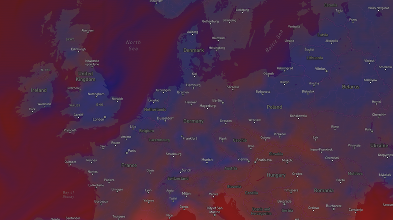
World-wide ozone data: Just after cutting through the 24-hour-mark, our developers have integrated near real-time (NRT) satellite data into our platform.
Oct 19, 17:33 CEST, Link
Did you know that ozone (O3) levels are generally higher over oceans? This is because there are no local nitric oxide (NO) emission sources; NO reacts with O3 and forms NO2 (nitrogen dioxide) and O2 (oxygen).
#SpaceApps #SpaceAppsHAMBURG19
If you are interested in joining our team and working on the cause of uncovering and improving global air quality and air pollution, check out our career pages for open positions or contact us with your speculative application.
 BUILTWORLD Real Estate Innovation Forum